

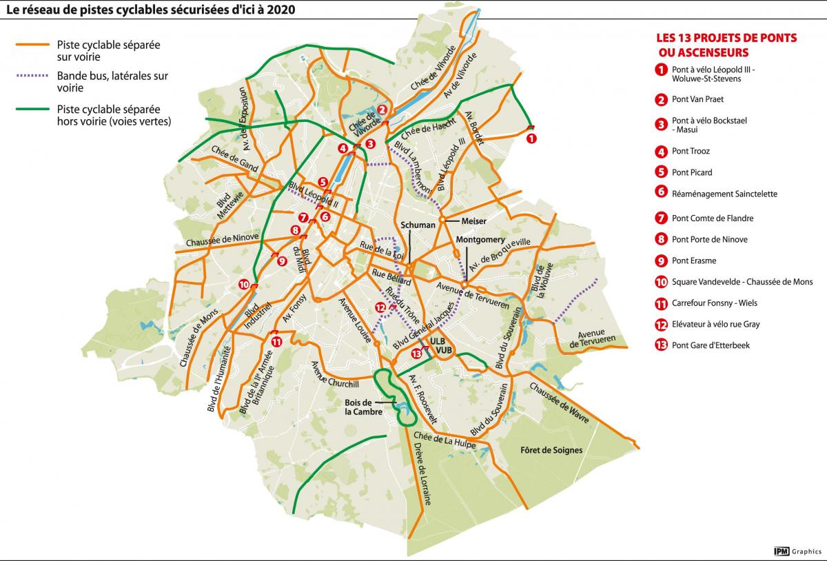
You can find on this page the Brussels bike map to print and to download in PDF. The Brussels bicycle map presents the bike routes and lanes of Brussels in Belgium.

The Brussels bike lane map shows all the bike routes of Brussels. This bicycles lanes map of Brussels will allow you to easily plan your routes with a bike in Brussels in Belgium. The Brussels bike lanes map is downloadable in PDF, printable and free.
In the centre of the city, bikes are often faster than cars. The City of Brussels has bike racks and boxes, rental systems of bikes, bike lanes and a Bike Commission. The City of Brussels has bike boxes on its territory as its shown in Brussels bike lane map. A bike box is a box with key access that can accommodate 5 bikes from local residents. The ICR (regional bike lanes) form a network of public roads that are fitted out to allow cyclists to ride in safety.
A new two-way biking lane will run along parts of the E40 motorway, linking Brussels and Flanders bike networks in the latest boost to biking infrastructure in Belgium (see Brussels bike lane map). The new bike lane is part of plans to bolster cycling networks across the country to make inter-regional commutes by bike safer, Brussels Mobility spokesperson Camille Thiry told The Brussels Times.
The best way to find your own biking lanes is to take a look at the Brussels bike lane map, available for sale in a waterproof hardcopy or for free download. The map shows the contours of hills and also codes the streets of Brussels in terms of their openness for bikes. It can seem a little complicated at first, but once you learn how to read it, you wont leave home without it.