Brussels airport map
You can find on this page the Brussels airports map to print and to download in PDF. The Brussels airport map presents terminals and gates of the international airport of Brussels in Belgium.
Brussels airports map
The Brussels airports map shows all the airports around Brussels. This airports map of Brussels will allow you to determine which airport you will used to leave Brussels in Belgium. The Brussels airports map is downloadable in PDF, printable and free.
Brussels is served by two international airports servicing premium and budget airlines alike, Brussels Airport which is located in the nearby Flemish municipality of Zaventem, and by the smaller Brussels South Charleroi Airport, located near Charleroi (Wallonia), some 50 km (30 mi) from Brussels as its mentioned in Brussels airports map.
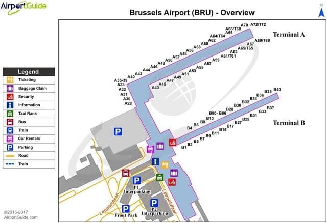
Brussels international airport map
The map of Brussels airport presents the main international airport of Brussels. This international airport map of Brussels will allow you to determine by which terminal and gate you will arrive or leave Brussels in Belgium. The airport Brussels map is downloadable in PDF, printable and free.
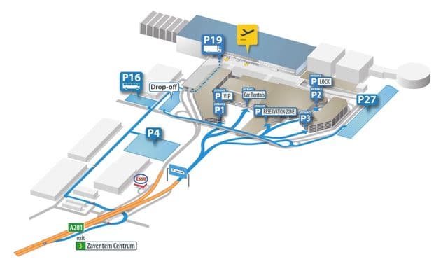
Brussels international airport parking is free for 15 minutes at car parks P1, P2 and P3. You can use this express parking for a quick drop off or pick up at Brussels Zaventem airport as its mentioned in Brussels international airport map. And if a delay happens, the fee for 1 hour is €7 at P1 and €4 at P2 & P3. For long term parking at Brussels international airport there is a complicated pricing scheme.